

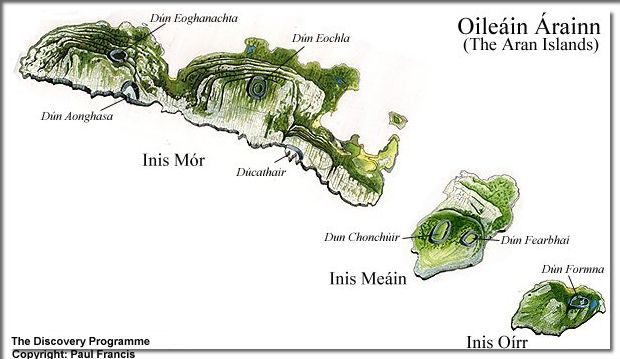
"The geography of the Aran Islands is very simple, yet it may need a
word to itself. There are three islands: Aranmor, the north island,
about nine miles long; Inishmaan, the middle island, about three
miles and a half across, and nearly round in form; and the south
island, Inishere--in Irish, east island,--like the middle island but
slightly smaller. They lie about thirty miles from Galway, up the
centre of the bay, but they are not far from the cliffs of County
Clare, on the south, or the corner of Connemara on the north"
J M Synge - The Aran Islands - 1907
J M Synge - The Aran Islands - 1907
 on limestone at Inis Meáin")
Inis Meáin - Inishmaan
(Middle Island)
Ferry or Plane
One inch map and a companion guide.
Tim Robinson - Folding Landscapes - 1996
The Aran Islands - J. M. Synge
First published 1907
Inis Meain Images: Ten Days in August 1912
Watson, Henry Cecil
Dublin: Wolfhound, 1999
Wikipedia
Aran isles - Inis Meáin